
 Image 1 of 1
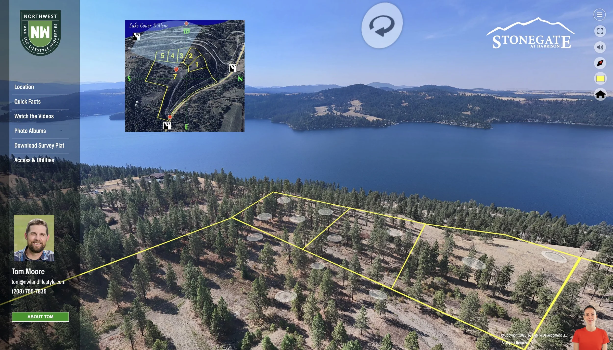
LandVision360 is our own platform for creating a tour-centered web site for ranch, estate and acreage sales. Every one of our LandVision 360 projects tells a unique story. They are delivered as a dedicated web site for your property that features an interactive 3D tour from the sky to locations on the ground, with critical features and property facts embedded in the tour experience. Every LandVision tour includes:
More intuitive and engaging than commercial virtual tour products
A series of linked, interactive 3D aerial panoramas covering the entire parcel
Aerial video and photography of the parcel, and territorial views from the parcel
Property lines placed visibly on the landscape within the 3D tour experience
3D virtual tours of buildings on the land.
Landscape photography and photos of important parcel features (power and water access, septic resources, access roads, etc.)
Custom video pieces that showcase the location and nearby community
Google 3D Earth plats, animated and with narration to explain the topography and region
Downloadable plat, surveys or other technical documents you wish to share with potential buyers
Branded and MLS-compliant versions of the tour. Branded view includes any biographical content content and media you provide.
Contact us for a quote. LandVision360 pricing varies based on the acreage covered, the number of structures scanned and amount of video production required. Typical projects range from $650 to $1200.